

PRODUCT
QPATHS
QPaths is a tool that helps local authorities quickly assess the eligibility for home to school transport based on safe walking routes, catchment areas, and closest appropriate schools. With QPaths you can share visual references to help parents understand eligibility decisions, reducing complaints and shortening the appeals process.

What is distance
eligibility?
There are several criteria which may determine whether a student qualifies for free home to school transport. One of them is the distance between their home and the school. Typically, if a student’s safe walking route from home to school is more than three miles (for secondary age children), they are eligible for home to school transport.

How automated distance eligibility software can help transport planners
‘Safe’ is the word that makes calculating distance eligibility difficult because shortest isn’t always safest. When we initially worked with North Tyneside to develop QPaths, their team relied on free mapping tools and local knowledge (to divert routes around unsafe paths). Processing the transport requests involved manually inputting them one-by-one and cost weeks of time. Automating the process allows you to make accurate, transparent eligibility decisions – with a full audit trial – and share them easily with stakeholders.
See QPaths in action
Product specialist Mariesha shows how QPaths gives you a safe walking distance and an indicative eligibility decision from a pupil postcode
Text description
Hello, my name is Mariesha, and today I’ll be talking to you about QPaths.
QPaths is a tool that helps local authorities quickly assess eligibility for home to school transport based on safe walking routes, catchment areas and closest appropriate schools. Planners can block unsafe roads or paths within QPaths, and these are then avoided in the routing calculations. Planners are then given safe, unsafe or driving route calculations to inform their eligibility decisions.
I’ll show you how to add an enquiry into QPaths. You can paste the postcode here into the address bar, search for the addresses associated with that postcode, choose a school, and add that enquiry into QPaths. QPaths will give me the safe walking distance and an indicative eligibility decision, and I can also view the route.
By turning on the map editor here, I can see the unsafe segments in this area of the map. By switching from safe to unsafe walking, I can see whether this route interacts with those unsafe segments.
Catchment areas, closer school checks and other eligibility policies can be modelled within QPaths. QPaths can also process bulk files to quickly determine eligibility for your whole cohort.
It can be used to provide evidence for policy review, for example a change of eligibility distance or a change to catchment priority. QPaths can identify where investment in infrastructure will deliver returns, such as improving the footpath network, and it can quickly assist with compulsory DfE reporting.
If you’d like to hear more about QPaths or arrange a demo, please get in touch.
We absolutely love how easy QPaths is to use. The accuracy and efficiency we have gained in assessing our applications has been invaluable. The team at QPaths are also incredible in the service and support they provide.
Charlotte Masterson-Cox
Eligibility Officer, School Transport Service Children’s Services
Hampshire County Council
Why this matters
Move faster
Cut down on manual processing which takes weeks of time and respond to clients sooner. With QPaths you can accurately batch process thousands of requests in minutes. Now even faster!
Multiple access points
Where an establishment has multiple access points (gates), QPaths calculates the walking distance from the origin address to the nearest gate (per enquiry). This improved accuracy enables stricter adherance to policy which can reduce transport costs.
Manage safe walking routes
Children’s safety is the priority when identifying walking routes. QPaths allows you to define what is ‘unsafe’ to fit your framework, e.g. unlit pavements, dangerous road crossing points, high pollution levels, so you can exclude them from results. The ability to ensure that all the walking routes you define are safe and fit for purpose gives you complete peace of mind.
Instant responses through API
Cut down on the number of applications you need to process by giving parents an instant response to their eligibility questions via API. Users can override automatic decisions.
Define school catchments
Easy upload of catchment shapefiles to include school catchment checks in your eligibility decisions
Google Street View integration
Instantly inspect areas by clicking through to Google Street View
Address validation
Geocode addresses in seconds using Ordnance Survey’s Address Base to ensure accurate and consistent routing.
How QPaths makes
life easier
- Easily calculate statutory walking distances
- Where appropriate also delivers driving distances
- Quickly check walking or driving distances to a preferred school or nearby schools
- Test hundreds of walking path distances in minutes.
- The calculation uses the most up-to-date mapping available from Ordnance Survey.
- Understand the impact of policy changes, for example, eligibility based on nearest vs. catchment school
- Understand the return on investment from new infrastructure, such as crossings and street lighting
- Easily view a list of the nearest appropriate schools
- Help parents find alternative options when schools are oversubscribed
- Clear and consistent information for rapid appeals resolution and decision auditing.
- Override transport eligibility decisions and record the reasons why (e.g., low income families) when necessary.
QROUTES
Route optimisation for shared journeys when costs, carbon, and journey experience really matter. It’s designed for SEND and Mainstream transport planners who know and care about what good looks like, and want to find savings of up to 20% more than competing optimisation products.

QPaths has been a valuable aid in transport appeals allowing us to accurately advise parents/carers and to provide a map of the route and the nearest establishments to their home address for their information.
Vicky Spence
Commercial and Client Engagement Officer, Transport and Travel Services
Nottinghamshire County Council
Latest insights
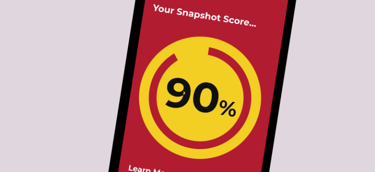
Snapshot Scan: benchmark your school transport network for FREE
QRoutes has launched Snapshot Scan, a free online service that benchmarks the efficiency of councils’ home-to-school transport networks.
School transport is one of the fastest-growing pressures on council budgets, yet many councils have no way to understand the efficiency of their network without costly transport reviews.

Resilient Networks, Defensible Budgets
Resilient Networks, Defensible Budgets is a practical guide for senior leaders on building a school transport service that’s more inclusive, more resilient and significantly more cost-effective

QRoutes joins G‑Cloud 15
QRoutes has been appointed to the UK Government’s G‑Cloud 15 framework, allowing public‑sector organisations to use the platform to procure its cloud‑based SaaS solutions – QRoutes Pro, QRoutes Vantage, and QPaths.